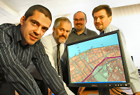
 GGP Systems has boosted the appeal of its Geographical Information System (GIS) and NLPG software with improved interoperability.
GGP 2008 provides easy access to records and mapping overlays held in other systems with the ability to store geometry data in Oracle Spatial Locator, Microsoft SQL Server and Postgres databases, allowing all spatial data to be stored in one centralised repository. The greatly reduces data duplication, improves data quality and makes corporate map overlays easily accessible throughout an organisation.
Crucially, data held in other GIS and gazetteer management systems can be easily accessed allowing organisations to upgrade to GGPs latest solutions which are particularly well suited for corporate local government implementation.
We work closely with our client base to ensure we continue to deliver the functionality they require and expect. Interoperability has been a primary focus for this latest version and this really opens up access to data so that it can be provided centrally and to underpin improvements in service, said Tim Maxwell, Managing Director and Founder of GGP Systems. We aim to remain at the forefront of product development, keeping abreast of advances in technology and supporting our users as they adopt new data formats and working processes. GGP 2008 is the culmination of many months of hard work and we have already started on the path to the next release that will include support for SQL Server 2008 Spatial Indexing and ESRI ArcSde.
As well as the improved interoperability with support for all major GIS formats, GGPs GIS offers improved Ordnance Survey MasterMap loading and rendering functionality, an interface for Pictometry oblique aerial imaging and Latitude/Longitude to British National Grid conversion routines that will open up the potential for Global Positioning Systems (GPS) based applications. GGP 2008 enhancements also apply to GGPs mapping to web solution eGGP, which enables maps and geographic information to be distributed via an Intranet or Internet service application, and GGPs market-leading gazetteer management software NGz.
By combining these popular elements into a single product portfolio we are empowering our users, giving them the tools they need to release the full potential of geographic information internally to increase operational efficiencies, with third party organisations to facilitate joined up working and with the wider community for improved communication and customer service, concluded Maxwell.
NOTE - 'NLPG' stands for The National Land and Property Gazetteer - it is a new national Property ID scheme - in effect a postcode for every property which provides pinpoint accurate location and enables easy access to information about the property and surrounds.

Add a Comment
No messages on this article yet